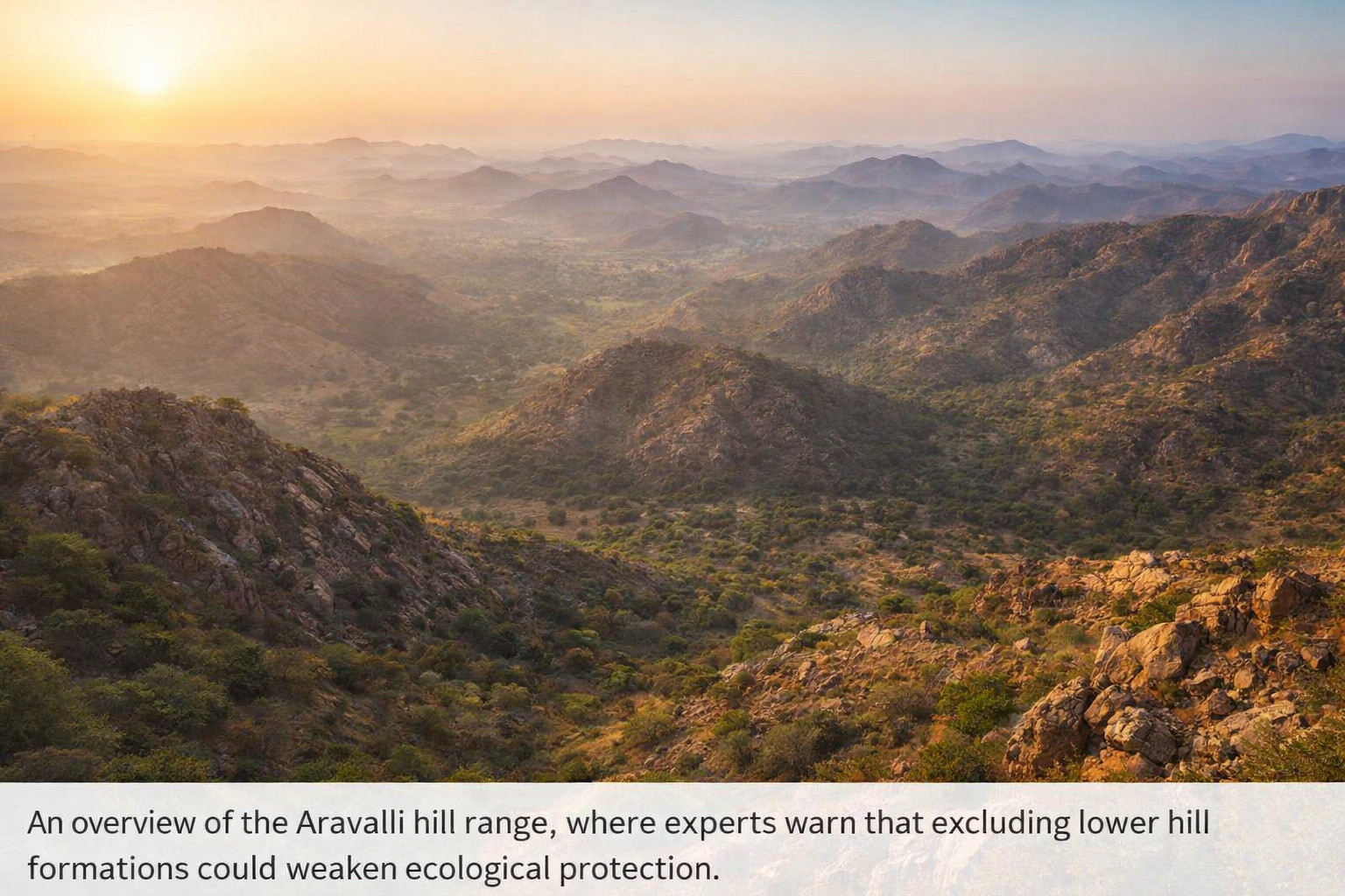
The Supreme Court’s acceptance of the Union government’s 100-metre definition of the Aravalli range has raised serious questions about environmental safeguards, especially as the court’s own expert body had earlier opposed the move.
On October 13, the Ministry of Environment, Forest and Climate Change (MoEF&CC) proposed a new definition of the Aravallis, categorising them as areas with a minimum height of 100 metres. The very next day, the Supreme Court-appointed Central Empowered Committee (CEC) wrote to the court’s amicus curiae, clarifying that it had neither examined nor approved the ministry’s recommendation.
Despite this communication, the apex court on November 20 accepted the ministry’s 100-metre definition.
CEC Backed FSI’s Broader Definition
The CEC, constituted by the Supreme Court in 2002 to oversee compliance with environmental and forest-related orders, reiterated that the definition prepared by the Forest Survey of India (FSI) should be adopted to protect the fragile Aravalli ecosystem.
In an October 14 letter reviewed by Indianewsupdates.in, the committee stated that the FSI’s definition was essential for the protection and conservation of the Aravalli hills and their ecological range.
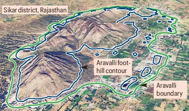
Under this definition, the FSI mapped 40,481 sq km of the Aravallis across 15 districts of Rajasthan, identifying areas with a minimum slope of three degrees. This approach ensured that even lower hill formations were recognised as part of the Aravalli range and protected accordingly.
The FSI carried out this mapping exercise after being engaged by the CEC under a Supreme Court order issued in 2010.
Dispute Over Committee Proceedings
In May 2024, the Supreme Court directed the environment ministry to form a committee under the Environment Secretary to arrive at a “uniform definition” of the Aravallis, aimed at preventing unregulated mining. CEC member Dr J R Bhatt represented the committee during these deliberations.
However, in its October 14 letter, CEC chairman and former Director General of Forests Siddhant Das stated that the committee had not received draft minutes of the meeting held on October 3 for review.
The CEC clarified that no examination of the ministry’s report had been carried out by the committee. It further said that views attributed to the CEC in the ministry’s affidavit before the Supreme Court were not those of the committee, but reflected the position of Dr Bhatt alone. The report submitted by the ministry was also noted to be unsigned.
The CEC reiterated that it was of the considered opinion that the FSI’s slope-based definition should be adopted.
Amicus Curiae Flagged Ecological Risks
In a detailed presentation submitted to the court, the amicus curiae relied heavily on FSI data to oppose the ministry’s 100-metre definition. He warned that the new approach would fragment the Aravalli range and compromise its ecological integrity.
According to the presentation, the “geographical integrity of the Aravallis is lost” under the 100-metre definition, which could lead to dispersal of the hill range and weaken conservation efforts. The approach proposed by the ministry was described as vague and unacceptable.
Using FSI maps, the amicus curiae explained that numerous hillocks and lower formations lie within the Aravalli boundary under the slope-based definition. Excluding them could open these areas to mining, potentially causing severe ecological damage, including the eastward expansion of the Thar Desert.
Conflicting Assessments on Mining Impact
Following the Supreme Court ruling, the Forest Survey of India issued a statement rejecting claims that it had conducted any study suggesting that 90 per cent of the Aravalli hills would lose protection due to the judgment.
However, an internal FSI assessment, shared with the ministry and the CEC, indicated that the 100-metre definition would exclude 91.3 per cent of Aravalli hills measuring 20 metres or higher across Rajasthan. If all 1,18,575 hill formations are considered, the assessment suggested that over 99 per cent would not meet the 100-metre threshold.
Ministry Yet to Clarify Future Safeguards
On Monday, Environment Minister Bhupender Yadav stated that mining is currently permitted in only 0.19 per cent of the Aravalli region, amounting to 278 sq km across Rajasthan, Gujarat and Haryana. However, official data shows that this figure reflects the existing mining area, not future potential zones.
The ministry has yet to clarify how mining and development will be regulated in the lower segments of the Aravallis once they are excluded under the new definition. The minister also said the actual extent of Aravalli areas covered under the 100-metre rule would be known only after ground demarcation, raising questions over how assurances were given to the Supreme Court beforehand.